Index guide
Country Draw
Country Draw is a daily geography game that hides one country on a real map, asks you to rebuild its border from memory, and scores the area you matched, missed, or drew outside the target.
The official game is loaded above. If it does not respond, open the publisher’s site in a new tab.
Player reviews
What did players make of it?
Loading player ratings…
Loading reviews…
Verified round model
How a round of Country Draw works.
Objective, input, feedback and stopping condition checked 24 August 2026.
Objective
Reconstruct the hidden country in the correct position on the map while minimizing both omitted land and area drawn beyond its real border.
Your move
Draw one or more pointer strokes on the map, with separate Draw and Move controls plus Undo and Clear for correcting the outline.
What changes
The reveal overlays matched area in green, missed land in red, and extra area in gold, then combines the missed and extra ratios into an accuracy score.
Round end
A round is scored when the player submits a drawable closed shape; the current target can then be retried or replaced through practice selection.
Why it stands out
Place the country first; coastlines come after the map agrees.
The difficult choice is not simply recalling a silhouette. The drawing must occupy the correct geographic space, so players have to trade coastline detail against proportion, orientation, and alignment with neighboring borders before the area-based reveal exposes where the model drifted.
Best for
- Geography players who want to test active recall rather than recognize a supplied silhouette.
- Learners who can use colored area errors to correct one border, proportion, or placement mistake at a time.
Think twice if
- Players who want a keyboard-only geography puzzle or an exact answer unaffected by drawing control.
- Streak players who need an archive of earlier dated challenges.
Build the envelope before the coastline
Country Draw grades area, not artistic resemblance. Before drawing, locate the capital marker and scan the borders around the covered space. Estimate the target’s northern, southern, eastern, and western limits, then decide whether the country is mainly tall, wide, diagonal, or split into islands. Those four limits form an envelope that protects more score than a carefully remembered bay placed on the wrong side of the map.
Start with the longest dependable boundary: a coastline, a straight land border, or the edge shared with a neighbor you recognize. Connect the largest turns first. Small coastal teeth are expensive to remember and easy to misplace, while the scoring model penalizes both land you omit and territory you invent outside the real shape.
Read the three colors as separate diagnoses
The final accuracy number hides two different errors. A large red missed area means the shape was too small, shifted, or missing a major projection. A large gold extra area means it spread too far or crossed a real border. Green only shows the overlap; a high matched value does not rescue a drawing that also claims too much neighboring land.
Correct the largest colored region on the next practice attempt instead of redrawing every bend. If most red sits to the east, move or widen that side. If gold collects along one neighbor, pull that shared edge inward. This turns the reveal into a geographic correction rather than a vague judgment about whether the outline “looked right.”
Choose the clue mode deliberately
Cover mode gives away the target’s footprint by masking its area, making it useful for learning proportions and shared borders. Capital mode removes that mask and leaves the capital as the principal anchor, so location becomes part of the recall test. Because the public client includes clue mode in the daily seed, switching modes can also change the target for the same local date.
Mapster is the nearest entry already in the Index: both ask for a daily country outline from memory. Country Draw earns a separate entry because its documented decision problem is tied to real map coordinates, neighboring geography, two clue modes, and an area reveal split into matched, missed, and extra regions. Its practice selector also makes correction repeatable without pretending that practice rounds are earlier daily puzzles.
How to play
- Open Today’s challenge, choose Cover or Capital clue mode, and study the surrounding countries and capital marker.
- Keep Draw selected and trace a closed border directly on the map; use Move when you need to pan or zoom without adding ink.
- Submit the shape, then compare its matched, missed, and extra areas before retrying the largest error in practice.
Game passport
A quick read before you play.
Play
- Mechanics
- Freehand map drawing, Geographic recall, Area-overlap scoring
- Input
- Pointer or touch drawing on a pannable and zoomable map
- Language load
- Low
Access
- Price
- Free to play
- Account
- Not required
- Mobile friendly
- Yes
Return
- Cadence
- Daily
- Archive
- Unavailable
- Features
- Stats: Yes · Sharing: Yes
Index status
- Editorial depth
- Guide
- Difficulty
- Demanding
Related games
Keep the same kind of attention.
good next step
Countryle
Countryle stays in Geography & Place, using geography as the way in.
same mechanic
Mapster
Mapster is the closest catalog comparison because it also asks for a daily country outline from memory; Country Draw specifically scores a border placed on a live map and separates matched, missed, and extra area.
good next step
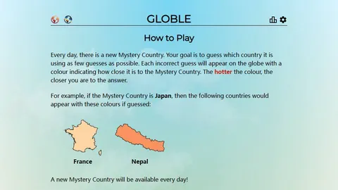
Globle
Globle keeps the daily country focus but replaces freehand recall with typed guesses and distance feedback, making it a useful option when map drawing is too dexterity-dependent.
good next step
Wordlar Ўйини
Wordlar Ўйини is another Brief Games pick, built around multilingual words.
good next step
SpellSlide
SpellSlide is another Brief Games pick, built around sliding tiles.
Before you play
Questions before you play.
- How is the daily country selected?
- The public client hashes the browser’s local date together with the selected region and clue mode, so the target is deterministic for that combination.
- What is the difference between Cover and Capital mode?
- Cover masks the target area while leaving the wider map visible; Capital removes that mask and leaves the capital marker as the main position clue.
- How does Country Draw calculate accuracy?
- The client measures overlap against the real geographic area, then subtracts both the missed-area ratio and the extra-area ratio from the score.
- Can you choose a country instead of playing the daily challenge?
- Yes. World practice lists 197 targets, with separate modes for US states, Canadian provinces and territories, Australian states and territories, and UK countries.
Source ledger
The evidence behind this page.
The anonymous live game, its public client and repository establish the official route, deterministic local-date target, map input, area feedback, practice pools, local statistics, sharing, and current access state. The submitted creator name remains explicitly bounded because the public profile only exposes an alias.
- Country Draw official game and instructionsOfficial, Web, checked 24 August 2026
- Country Draw public source repositoryCreator profile, Creator, checked 24 August 2026